Deschutes River Trail: Macks Canyon to Harris Canyon
-Trail Name: Deschutes River Trail
-Enter/Exit Point: Mack’s Canyon Campground
-Trail Type: In-and-Out
-Difficulty Level: Moderate due to distance, risk of falls and snakes/ticks
-Distance: 12 miles round trip
-Elevation: 580 feet
-Guide: https://www.oregonhikers.org/field_guide/Deschutes_River_from_Macks_Canyon_Hike
-Review: For the last 9 years I have been frequently hiking along the Deschutes River Trail from the mouth of the river up to 12 miles upriver ending at the Harris Ranch Homestead and Water Tower (both which were burned in past fires now). I knew the trail continued another 12 miles up river but never had the time or endurance to try and hike 24 miles in and 24 miles out. After doing a little research I decided to make the long drive to the Mack’s Canyon Campground (about 30 miles east of Maupin Oregon) to hike the final 12 miles from the other end of the trail.
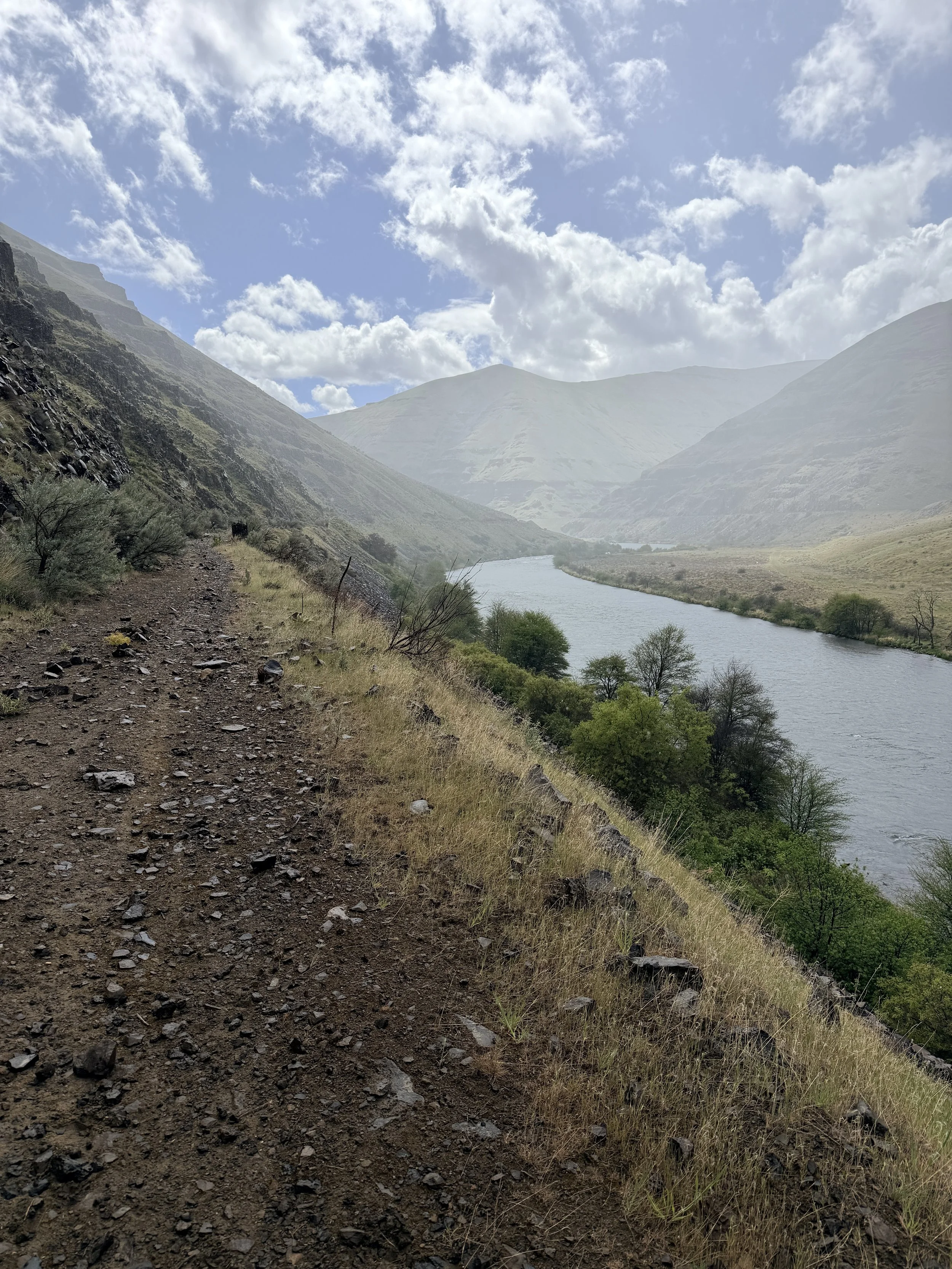
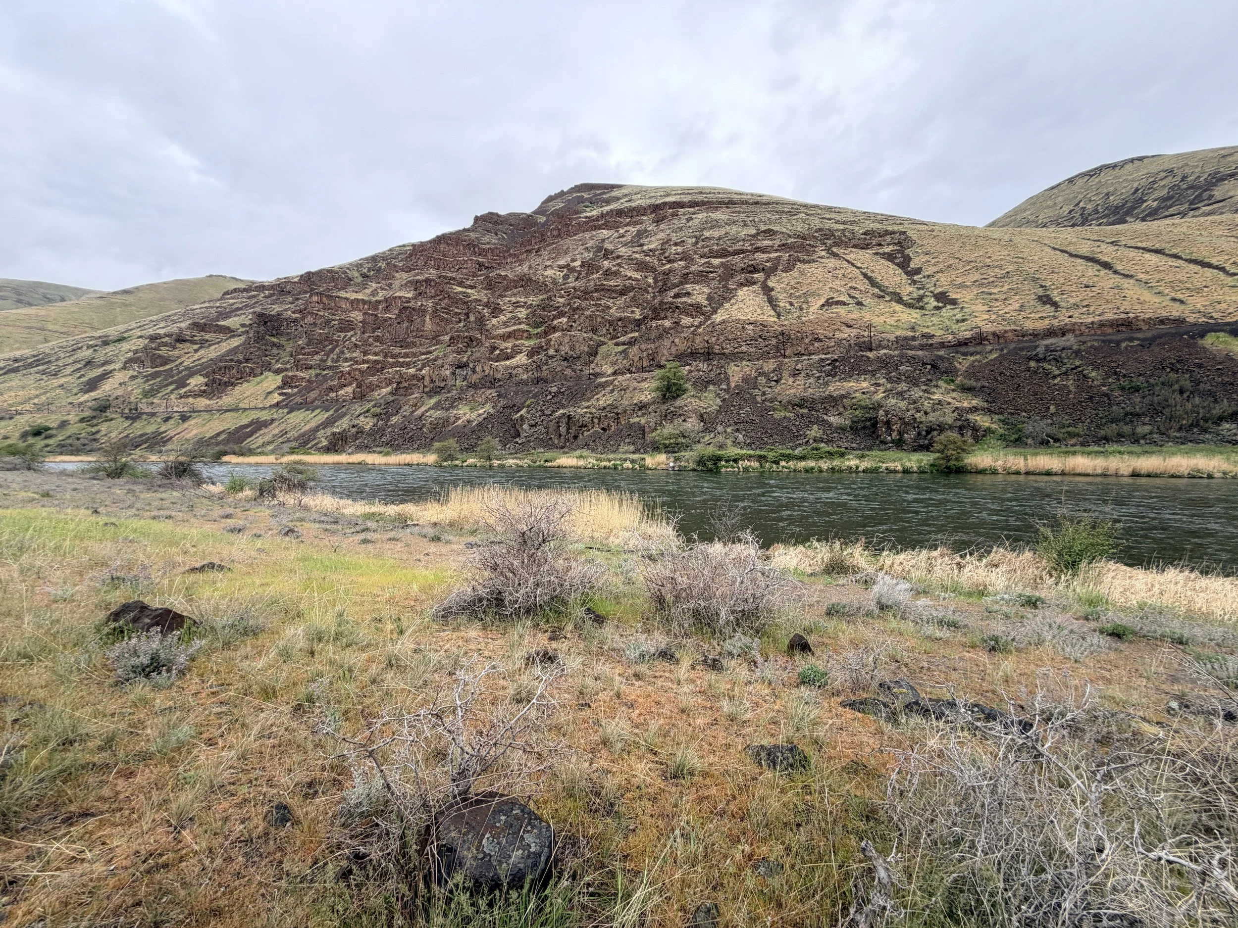
The trail started at the north end of the campground near the hairpin turn in the road. There was a fee to park in the campground but it was only a few bucks a night and there was a machine that took cards. The trail was a small single track size and was fairly obvious throughout most of the trail. The first 5 miles of trail do have a bit of tall grass and 6 canyons to cross that require hiking down, sometimes very steep terrain, and then back up the far side. There are a few small seasonal streams within the first mile and actual river access will require hiking down to the river so pack plenty of water.
I began my hike around 5pm on a spring day and hiked about 7.5 miles in before seeing some nice camp spots along the river. There are frequent camp sites, mostly designed for boaters, so it do not count on having all of the camp sites to yourself even if you don’t see any other hikers on trail. After spending a very restful night and packing up camp in a slight drizzle, I continued down the trail for another 5 miles. There were a handful of potential camp spots including ones on the hill side of the trail around 10 miles in but I did not see any easy water access there. Just before mile 12 you will begin to see signs of the former ranch and homestead. You will also come to a small water crossing that does allow for easy water access if you need to filter and refill your water stores.
From here I turned around and began my trek back to the trailhead. The majority of the trail is along the former railroad bed which is mostly level and makes for very easy walking. The first and final 5 miles have much rockier sections and you will occasionally have to cross over/around a barbed wire fence. I found the access areas of the fence easy to find and easy to cross. After 24 miles on the trail in April, I did not see a single other hiker but came across dozens of people boating and fishing along the river. If you want a more secluded hike along the Deschutes, this is the section of trail to hike. Although the camp sites are less obvious and there are no pit toilets it still made for a great backpacking experience. Cheers!
-Rating: Bag it!
Rating Guide:
-Gram it: Check out the pictures on Instagram because this one is not worth seeing in person
-Hike it: It’s short and sweet. Might as well knock it out in a day
-Bag it: Pack a bag and spend the night
-Bring a friend: Easy enough to bring a friend. Maybe this is where you can introduce someone to backpacking.
-Come Back: I will keep doing this trip it’s so good.