Cape Horn Loop Day Hike
-Trail Name: Cape Horn Loop
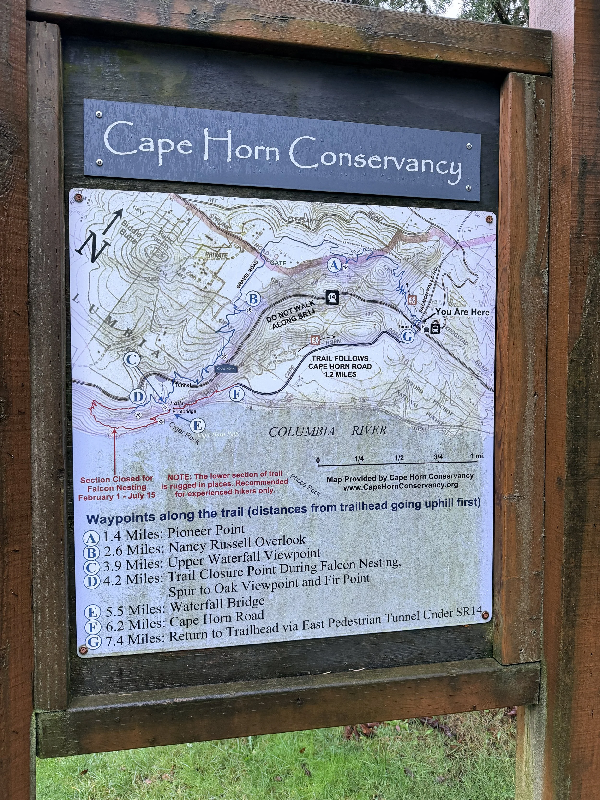
-Enter/Exit Point: Cape Horn Trail Head (off Salmon Falls Road and SR-14)
-Trail Type: Loop (when trail is fully open)
-Difficulty Level: Moderate due to distance, elevation, terrain and cliffs
-Distance: 6.71 Miles
-Elevation: 1,280’
-Guide: https://www.oregonhikers.org/field_guide/Cape_Horn_Loop_Hike
-Review:
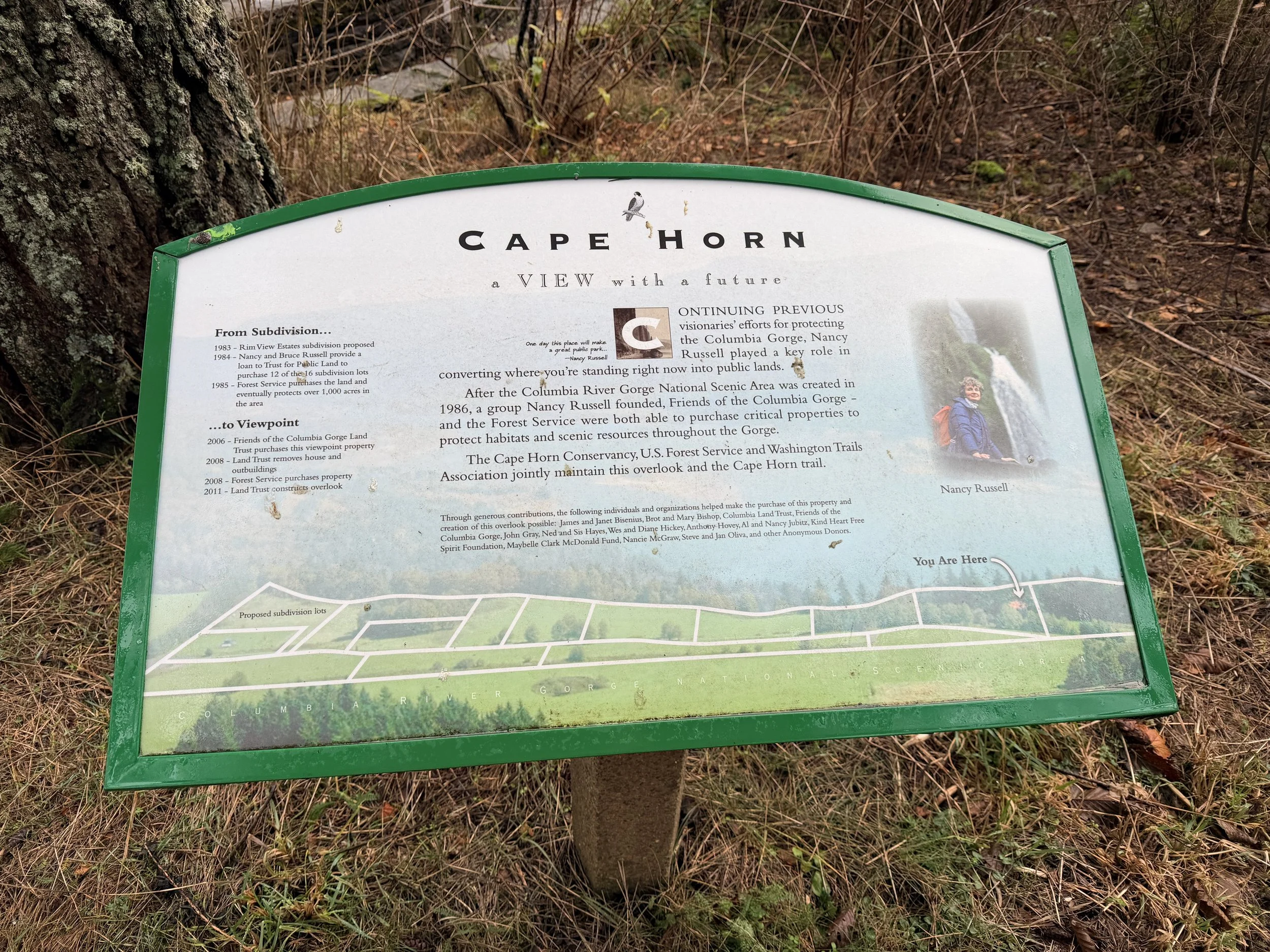
For years I have driven by the various Cape Horn Trail Head parking areas and have always wondered what hike these people were doing. After a little research I planned a winter trip in 2024 but waited to long as the trail is closed form February 1st to July 15th due to nesting Pereguin Falcons.
Thankfully in December of 2025 I was able to hit the trail with a couple of friends. We began at the parking area off of Salmon Falls Road which has bathrooms, trash cans and does not require a parking pass. The trail begins and ends just across Salmon Falls road and if you hike it counter clockwise like we did you will veer to the right and up the hill. The majority of the elevation will be gained over the next 1.25 miles. We did encounter a few down trees along the trail, the worst of which was shortly after the trail began. Recent rains led to a muddy trail and my trekking poles kept me from falling on numerous occasions but overall the trail was very pleasant. The climbs were not too steep at any point to require stoping to rest but I did keep a nice leisurely pace.
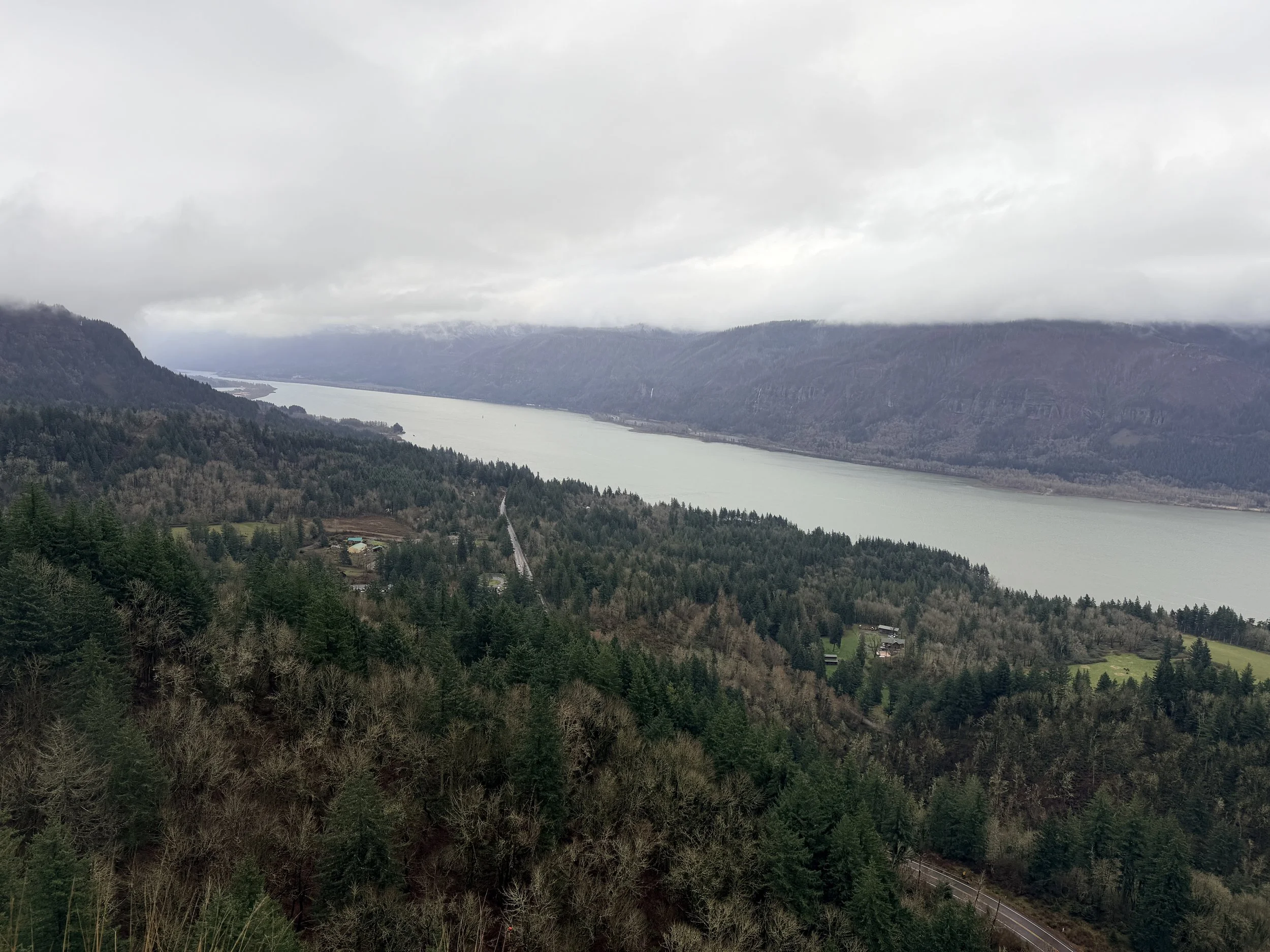
After climbing the ridge you will begin to traverse west for over a mile. The views vary from dense forest to open fields and beautiful views of the Columbia River Gorge. The majority of the creeks you cross have bridges and Highway SR-14 has tunnels under it for the hikers to use. You will switch back down to within a hundred feet of the Columbia River (careful of the edges in this area) before you cross a short rock field with a handful of switchbacks. Immediately after this you will come upon a waterfall which looks like at one point had a bridge across it. Thankfully the trail goes behind the falls and other than some mist will likely not leave you wet. From here the views to the Gorge continue as you hike down to a parking/turn around area where you will link up with a paved road for apron. the next 1.5 miles. As you begin to hear the cars on SR-14 again you will see a sign marked “Trail” to your left which will take you the short distance to the second tunnel under the highway and then back to Salmon Falls Road where you will cross and end back at the parking lot. This is a tough but beautiful trail that is very close to Washougal Washington. Cheers!
-Rating: Come Back!
Rating Guide:
-Gram it: Check out the pictures on Instagram because this one is not worth seeing in person
-Hike it: It’s short and sweet. Might as well knock it out in a day
-Bag it: Pack a bag and spend the night
-Bring a friend: Easy enough to bring a friend. Maybe this is where you can introduce someone to backpacking.
-Come Back: I will keep doing this trip it’s so good.